- Thumbnail
- Resource ID
- eda342da-10eb-11ea-8d7d-000d3ab6a624
- Title
- vsip major roads Volta River basin
- Date
- May 31, 2019, 2 a.m., Publication
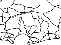
- Abstract
- This data was collated to support the Volta River Basin Strategic Action Programme Implementation Project (GEF ID 6964). The project objective is to strengthen transboundary water resources management in the Volta River Basin through the Volta Basin Authority, including implementation of priority actions of the Strategic Action Programme. This layer contains the major roads within the Volta River basin.
- Edition
- --
- Owner
- volta
- Point of Contact
- Purpose
- Creation of maps of the Volta River basin.
- Maintenance Frequency
- unknown
- Type
- not filled
- Restrictions
- None
- License
- Not Specified
- Language
- eng
- Temporal Extent
- Start
- --
- End
- --
- Supplemental Information
- No information provided
- Data Quality
- --
- Extent
-
- long min: -5.9652480484
- long max: 3.0098212037
- lat min: 4.9833330000
- lat max: 15.0010451368
- Spatial Reference System Identifier
- EPSG:4326
- Keywords
- no keywords
- Category
- River Basins
- Regions
-
Africa
,
West Africa
,
Benin
,
Burkina Faso
,
Cote d'Ivoire
,
Ghana
,
Mali
,
Togo